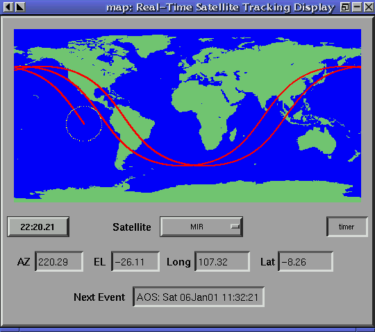
I'm working on a project related to astronomy and orbital mechanics. I have some data for a celestial body(for example a satellite or moon...) like it's Azimuth/Elevation, sidereal time of observation, longitude and latitude of observation site... I can calculate Right ascension and declination of the target by using above information. Well, We have for example 200 observation of the celestial body sorted by time (t1,t2,...tn) How can I change these information to Longitude/Latitude of the celestial body in geographic map for each time? I want to create a map like this:

(source: qsl.net)
*** I use python in my project.

Look at the example here http://www.stargazing.net/kepler/altaz.html You are working backwards from RA and DEC and you should get Long from the LST and LAT from setting ALT to 90 and rearrange.